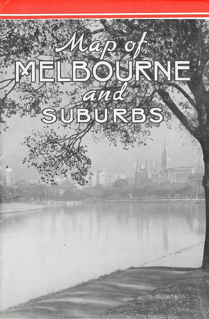
This vintage Melbourne travel map was passed on to me from the collection of a relative, and I thought Melbourne map buffs might find it interesting. Produced by the Victorian Railways in November 1939, it’s a small booklet that folds out into a double-sided map. This is the front cover when folded, showing the central city from the banks of the Yarra.
Folded up the booklet is about a modern A5 size; the first unfold reveals a landscape picture of Melbourne that is approximately A3. They don’t make them like this any more (while the booklet is from 1939, this drawing actually has a January 1934 copyright). You can click on all these pictures to study the detail.
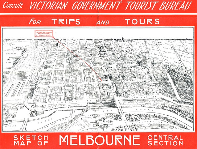
Various little things I noticed on this drawing:
- It seems there used to be an aquarium up near (or in) the Exhibition buildings.
- This shows a “Queen Victoria Hospital” up in what is now the legal precinct, off William Street. The Swanston Street site we now know as the former Queen Victoria Hospital is labelled “Melbourne Hospital.”
- Similarly, what we now refer to as the former GPO is marked as “Elizabeth Street Post Office,” with the actual “General Post Office” down near Spencer Street (which makes sense given the proximity to boats and trains).
- Flinders Street Station carries the label “The Gateway of the Metropolis.”
- There’s a cluster of theatres (including a “Hoyt’s”) on Bourke between Swanston and Russell. I can remember this remaining as cinema precinct until the 1990s, but all are gone now.
- Princes Bridge Station is still a separate entity. (Why did that linger for so long given its proximity to Flinders Street?)
The inside page folds down above the words “For Trips and Tours” to reveal the inner map of Melbourne, at close to A3 size. Again, click to enlarge.
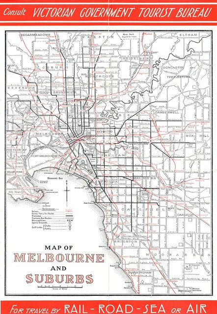
This isn’t quite as full of interest as the drawing of central Melbourne, but there are a few interesting details:
- The old Inner Circle railway is still there, running through North Fitzroy and North Carlton, including a branch line to Edinburgh Gardens. The last remaining section of the old Outer Circle (apart from today’s Alamein Line) also remains, running to East Kew.
- Coode Island is still an island, with the original course of the Yarra much more apparent.
- Mental health facilities are notably prominent: a “benevelont asylum” in Moorabin at the bottom of the map, the Kew asylum near the centre, and the terriyingly large “Mont Park Hospital for Insane” at the top.
- Pentridge prison is labelled “Pentridge Stockade.”
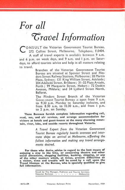
Just for good measure, here’s the back cover when the whole thing is folded up, which invites you to “call upon the Travel Hostess” at the Victorian Government Tourist Bureau.