
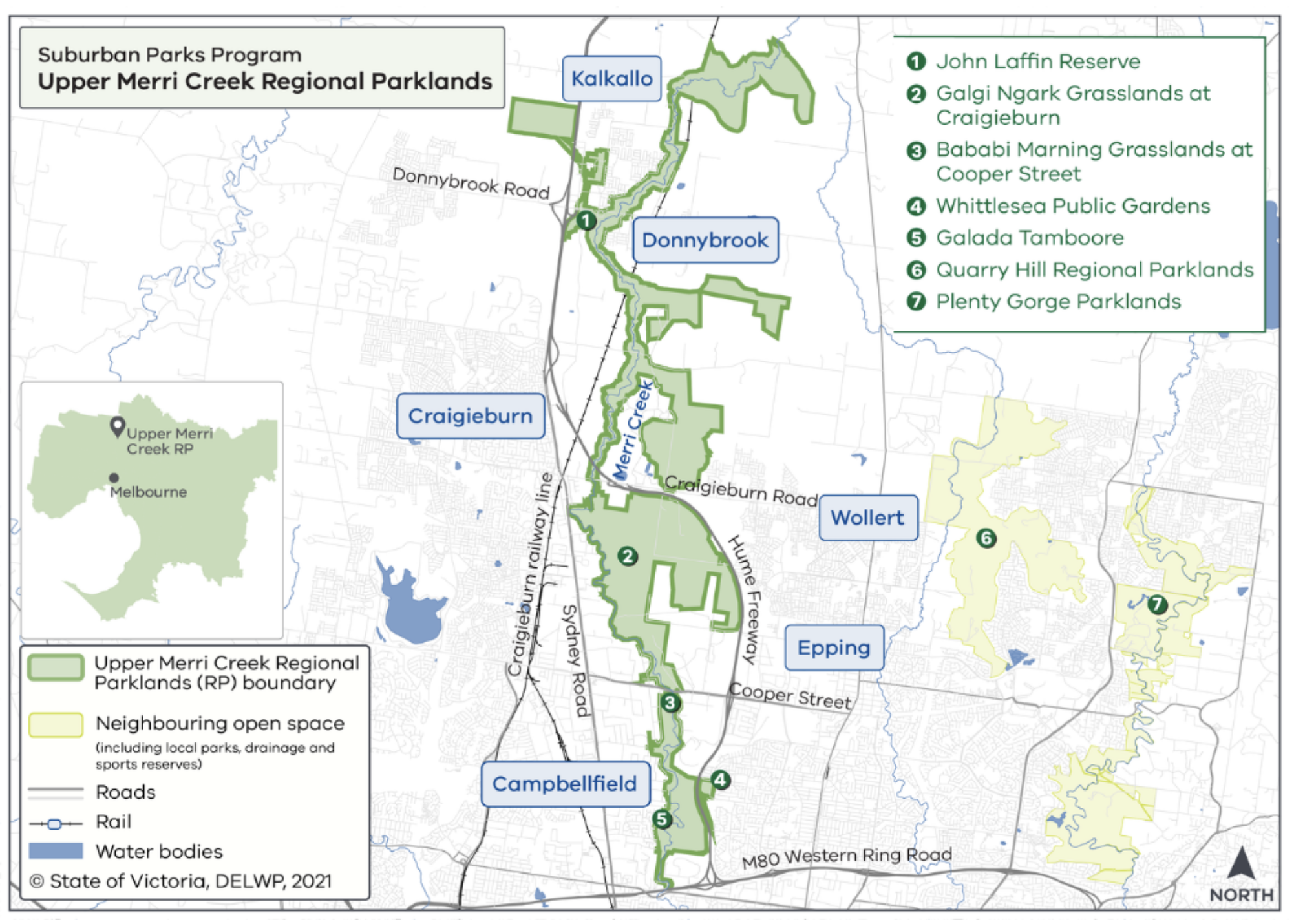
Less than three weeks before the last state election in 2018, the State government proudly affirmed their commitment to creating a “ring of new parkland in our growing suburbs.” This included creating a “new 2778 hectare Upper Merri Park” near Craigieburn. This park is to be combination of large grasslands and linear space along the Merri Creek, stretching from the Western Ring Road at the south to north of Donnybrook. This would connect with the extremely high quality and important linear reserve along the Merri Creek that already runs south of the Ring Road from Fawkner to the Yarra River in Collingwood.
It’s a fantastic initiative, recognising both the importance of maintaining naturally vegetated corridors along waterways, and the enormous importance that such linear open space has to the suburbs that exist and are still developing along the creek.
It represents one of the weirdest and most disappointing matters I’ve been involved with as a planner, in which Melbourne Water and the Department of Environment Land Water and Planning (DELWP) seem to be marching unstoppably towards the inappropriate rezoning and disposal of land within an important environmental and recreational corridor.
It was a bit strange to read, however, because by that point I had already appeared (in July 2018) at VCAT representing the Friends of Merri Creek regarding an application to remove a reserve over part of that creek corridor in Thomastown, one step towards selling that creek land to the smallgoods manufacturer that backs onto the creek. (We weren’t successful). It represents one of the weirdest and most disappointing matters I’ve been involved with as a planner, in which Melbourne Water and the Department of Environment Land Water and Planning (DELWP) seem to be marching unstoppably towards the inappropriate rezoning and disposal of land within an important environmental and recreational corridor.
While the land in question is currently within the Public Use Zone and owned by Melbourne Water, from the 1980s it was appropriated by adjacent industry (since sanctioned by retrospective planning permits) that extended the industrial development into the Melbourne Water land along the creek. While planning permits have since sanctioned the industrial construction on the land, it has never been permanently alienated from public use. It retains its Public Use zoning, and Melbourne Water remains the landholder.
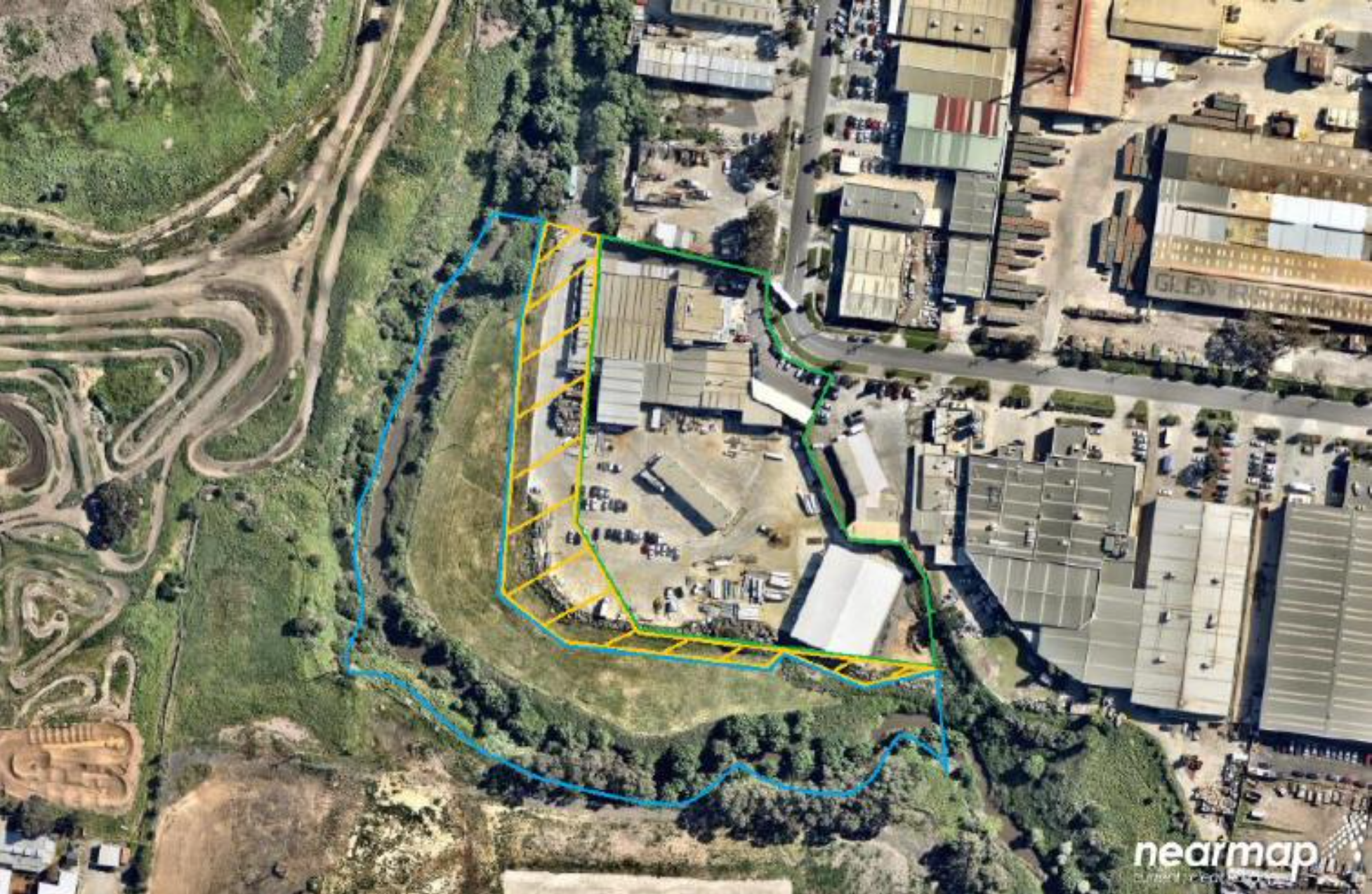
That is about to change, however, with a current Planning Scheme Amendment (C257wsea) proposing to rezone the land to Industrial 1 Zone, the most intense of the various industrial zones available in Victoria. This would be the final step in facilitating Melbourne Water selling the land to the current landholders of the adjacent site, Bertocchi Smallgoods.
It is difficult to reconcile this decision not only with the electoral commitments, but also various aspects of state planning policy (not to mention simple principles of sound planning). For example, it is policy at cl 14.02-1S of the Planning Policy Framework to retain natural drainage corridors of 30 metres width along each side of waterways to minimise erosion, polluted runoff and maintain natural drainage corridors. Here, though, the corridor is to be narrowed from around 33 metres at its northern end to around 15 metres.
The state policy also (at cl 19.02-6R) also specifically mentions the extension of the Merri Creek parklands to Craigieburn. This is policy with a long history that predates the 2018 election commitments. The extension of the Merri Creek parklands was recognised as a priority in Parks Victoria’s Merri Creek Marran Baba Parklands Strategic Management Plan in 2013.
Interestingly, neither cl 14.02-1S nor 19.02-6R is mentioned in the explanatory report for the amendment or the supporting planning report. Clause 14.02-1S is a particularly striking ommission as cl 14.02 is the clause relating to Water and 14.02-1S relates to “protection and restoration of catchments, waterways, estuaries, bays, water bodies, groundwater, and the marine environment.” It is arguably the most obviously applicable clause in policy to an amendment prepared on behalf of Melbourne Water to sell land adjacent to a creek; it is difficult to imagine that Melbourne Water overlooked it. Yet both reports’ discussion of policy skips over clause 14.02 as if it doesn’t exist.
It is not, however, the only odd point in the explanatory report. For example, the report notes that:
The amendment is not likely to affect any other government agencies. However, the amendment has been prepared in consultation with the local council and important community groups, including the Merri Creek Management Committee. The views of these stakeholders have been considered in the preparation of the amendment and the finalisation of landscaping, revegetation and weed management plans for the land affected by the amendment.
While the Merri Creek Management Committee were consulted about landscaping required as a condition of a previous planning permit, they were not in fact consulted about the amendment and are strongly opposed to it. Similarly, the long-established and very active Friends of Merri Creek group is also opposed. (And this is a good point to make my disclosure completely clear that I have done work for both groups, including in relation to this matter.)
It seems odd, to say the least, to mention consultation with such organisations and not mention their vehement opposition to what is proposed.
The report also says as follows about landscaping:
As part of the sale of the land and planning permit to facilitate the subdivision of the land, landscaping works are expected to occur in the creek corridor. The landscaping works and planting regime for the creek corridor have been developed in consultation with the Merri Creek Management Committee and Whittlesea City Council.
Early preparatory works on landscaping and weed management commenced in December 2020 and are likely to be completed by the end of 2022. These landscaping and weed management works will result in an improved environmental condition to the creek corridor on the land affected by the amendment.
The crucial point here is that landscaping was required as a condition of previous planning permits. There is not, as far as I can see, any basis to suggest that the amendment in any way facilitates or secures new landscaping that wasn’t already supposed to be achieved as a consequence of the previous planning approvals.
More importantly, though, narrowing the corridor inherently compromises the long-term ability to provide adequate landscaping for both habitat and visual screening of the industry. There are limitations to how the land can be landscaped without impeding floodwaters, which means the additional setback distance is crucial for an effective positive visual filter for a future shared pedestrian-cycle path along the creek (which is expected to be constructed soon on the other side of the creek).
In short, while the encroachment of industry has led to some poor outcomes on this site, which in the past the council and Melbourne Water have (I think ill-advisedly) sought to manage through permit conditions, the landscaping outcomes have still not been achieved as required by permit condition. And while the permits have authorised various industrial works on the land, Melbourne Water remains the landowner, and the land remains zoned for public use. Even if it takes some time, the possibility currently remains for the land to be returned to use as a vegetated buffer for the creek in accordance with state policy. That will be extinguished if it is rezoned and sold.
Unfortunately, while the amendment is currently out for public submissions, those submissions will be referred to the Government Land Standing Advisory Committee. It is outside the GLSAC’s terms of reference to address whether the land is actually surplus to requirements or not.
The GLSAC therefore has very limited ability to address the critical issues raised by the amendment. However Melbourne Water and DELWP have no such excuse. The proposal is contrary to state policy about development adjacent to waterways and will turn land over to industry that should ultimately be part of a significant regional parkland asset. The explanatory report doesn’t even mention the critical state policies, let alone explain how they are addressed.
Melbourne Water should not be contemplating the sale, and DELWP should be indicating to them that the rezoning is inappropriate. (I would also like to think Parks Victoria would have something to say about the disposal of the land.) Any agreements with the landowner should surely have been made pending the approval of the rezoning and not have prejudiced the Minister for Planning’s ultimate consideration of the amendment. It should therefore still be possible for the Minister to retain this land for the future parkland along the Merri Creek.
As far as I can tell, the current Planning Minister has never made a substantive determination about this land; this process was started a long time ago and it appears likely that it has only crossed his desk for the routine referral to the GLSAC. I hope that when the matter does come to him for a final determination of the amendment, he casts a very critical eye over it.
I will finish with a contrasting situation. Back in 2017 I represented objectors in Spry Street Coburg, who were fighting alongside Moreland City Council against the redevelopment of a block of land at the bottom of Spry Street in Coburg. That land was all zoned for residential use, but had a single house on it with a huge backyard that backed onto the creek. The developers wanted to build units on the land that would have extended much closer to the creek than the existing building line.
We won that case, and the development was refused. Council subsequently bought the land, and when I last went past the land was being turned into public open space.
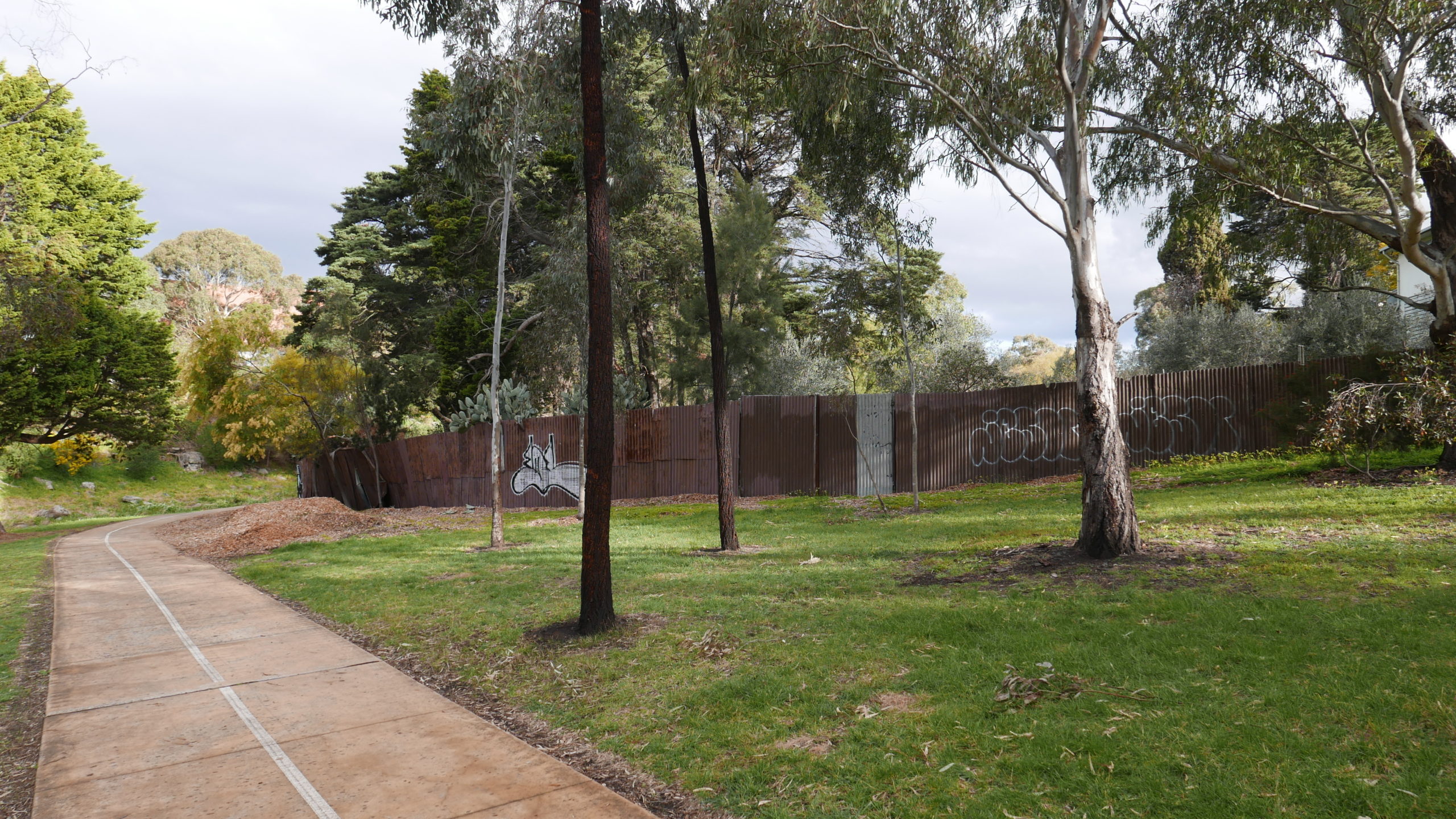
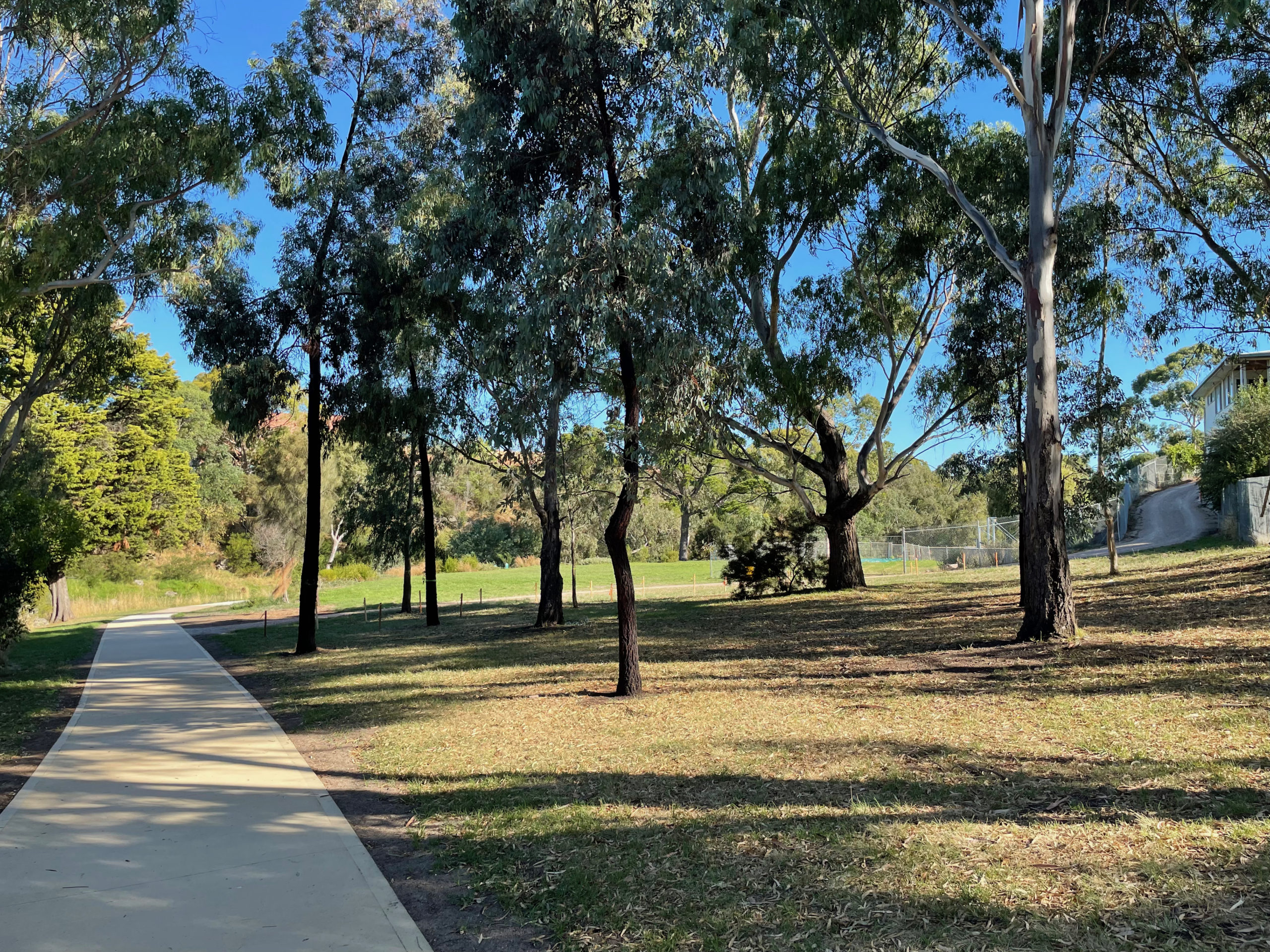
I raise this because Moreland got it. The existing creek reserves along Merri Creek, as with many other urban waterways, are precious ribbons of protection for the waterway. Every metre that can be added to such corridors is golden, and when an opportunity to add land arose, Moreland took it.
It boggles the mind that Melbourne Water would actually dispose of land that they already have along the creek.
There is a minor update regarding this issue here.